

Issue #: 168
Published: November / December 2019
- Price per issue - digital : 6.20€Digital magazine
- Price per issue - print : 8.50€Print magazine
- Access to Multihulls World digital archives Digital archives
We are still just off the northern coast of Flores, a 360km (220-mile) long island to the north of Indonesia. For the last few days the weather has been dead calm: no wind… At around 2pm a light breeze picked up. We were almost there, with just another 10 nautical miles to go.
Published 19/09/2019
It was a particularly misty day and the land was almost invisible. Finally, we were able to make out the island’s silhouette. Anyone wanting to paint it would need a palette of distinctly orange nuances.
These landscapes reminded me of the high plateaux of Madagascar, in the Tananarive area. Huge, isolated mountains, different shades of browns, with very few trees and magnificent rocky peaks.
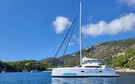
We approached Sada Bay, sailing along the coastline that was most exposed to the swell. The anchorage turned out to be extremely calm - at least once the anchor had been sent down twenty meters (65’). We were around 150-200 meters (450-600’) from the small coral bottleneck where we were supposed to be heading. Only a few boats could anchor there at the same time.
On the beach there was a tiny village. Everything looked perfect. A few sailing craft, some wooden huts, lots of children and constant smiles on the faces of the families that had come to get their fish.
I wasn’t surprised to notice that the sea was completely transparent, and that visibility was maximal. I couldn’t wait to take a dip and explore the seabed
Attention! You should never take Indonesian marine charts for granted. Very many reefs are uncharted and electronic charts are offset (Navionics).
Suggestion: there is a smartphone app (Ovital/Map) which allows you to download satellite images and then save them in your cache. They are very accurate and mean that you can avoid a lot of reefs, even if the best way is still just using your eyes!
On three occasions we realized that there was a coral barrier at the entrance to an anchorage, despite the marine charts not having flagged anything up before our arrival.
Arriving at Sada is relatively easy, but there’s no point trying to get closer into shallower water as the coastline drops away too steeply. We ended up anchoring in 20-25 meters (60-75’) of water.
Don’t expect the trade winds. In the north of Indonesia, at least close to the coasts, the wind is unpredictable.
In general, there isn’t much wind, and the forecasters struggle to predict the whims of the local weather.
It is always a good idea to check your engine before sailing in these areas.
However, despite this, in the month that we have been in situ, we have noticed that the wind does tend to pick up in the afternoon, so there is probably some thermal phenomenon at work.
It’s worth staying in this small anchorage for a couple of days to get the most out of it.
We will soon have seen everything, but we have some wonderful memories and it must be one of the best anchorages in the north of Flores.
Main activity: snorkeling. The cape at Sada is fabulous, and is full of deep crevasses, magnificent gogonians and many species of fish. It’s a wall which drops from 2 meters (6’) down to 200 (600’)…
On the beach the locals are adorable, and we left with lots of coconuts that they had given us. You can also climb up the hills to take in a fabulous panorama over the two bays and the large mountain chain which surrounds Flores.


What readers think
Post a comment
No comments to show.