

The Dominican Republic - Are you ready to discover the secrets of Los Haitises?
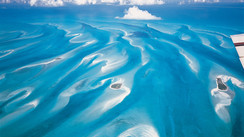
Destination - CaribbeanLos Haitises means “hilly land” in Taíno. This vast national park - which covers some 620 square miles (1,600 km²) - is home to rock formations that sometimes rise 100 feet (30 m) out of the water, immense mangroves and preserved tropical forests, as well as numerous birds - some of which are threatened with extinction. This beautiful land of adventure has the advantage of being set at the heart of Samana Bay, itself well protected from the ocean swell...
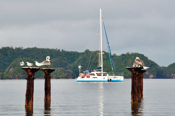
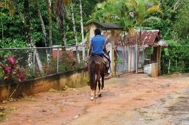
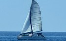
The pelicans play the post game in Bahia de San Lorenzo and hold on pretty well! They have to deal with the squalls and make the most of each clear spell. The waders are drying out and the birds of prey are keeping an eye on them. It is said that in the past, the Taínos Indians made the omnipresent geological formations here their shelters. The caves are indeed numerous.... The Arcna River area seems to have been inhabited for a very long time. The branches of this small brown river meander splendidly through the bright green mangrove. At the corner of one of them, between the bamboo, mangrove and coconut trees, chickens, ducks, turkeys and horses occupy a farm. This is probably a typical tourist spot, where visitors are taken to discover the surroundings by motorboat. But for the time being, there is a rescue mission going on! The heavy showers of the last few days, in addition to having brought a cold snap (relative of course as we are in an intertropical zone), have flooded parts of the country and swept away several boats.
The pelicans play the post game in Bahia de San Lorenzo and hold on pretty well! They have to deal with the squalls and make the most of each clear spell. The waders are drying out and the birds of prey are keeping an eye on them. It is said that in the past, the Taínos Indians made the omnipresent geological formations here their shelters. The caves are indeed numerous.... The Arcna River area seems to have been inhabited for a very long time. The branches of this small brown river meander splendidly through the bright green mangrove. At the corner of one of them, between the bamboo, mangrove and coconut trees, chickens, ducks, turkeys and horses occupy a farm. This is probably a typical tourist spot, where visitors are taken to discover the surroundings by motorboat. But for the time being, there is a rescue mission going on! The heavy showers of the last few days, in addition to having brought a cold snap (relative of course as we are in an intertropical zone), have flooded parts of the country and swept away several boats.
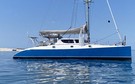
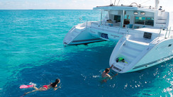
The gentle valleys stretch to the Ensenada del Naranja, east of Samana. The deluge has carried a phenomenal quantity of tree trunks and vegetation with it. It would be problematic if any of this debris were to get caught in our engines’ sail drives... The sun tries to break through, its continuous spectrum of light animating the grey sky. Our catamaran, Black Lion, is wedged between the green hills and is anchored in two meters of water. Further away, fishermen cast their nets. We are the only visitors. It is just fantastic! Nature, grandiose, is all around us and is a feast for our eyes. A boat comes to meet us, and we try to communicate with each other. A smile, a few words and we trade a bag of shrimps for a few pesos. This is just the kind of trip that we like!
Anchorage
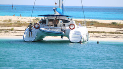
Los Haitises is an incredible national park that merits a long stopover on its own. It seems that the most “popular” anchorage is located at the following coordinates: 19°04.845’N 69°28.249’W. Here you can enjoy a good sandy bottom in only 12 feet (4 m) of water. There are many other anchoring possibilities in the park.
Weather
Samana Bay is very protected, deep and sheltered from almost all winds, which usually blow East-South-East in this area. The Samana Peninsula, located in the northeast of the Dominican Republic, is characterized by a humid and warm tropical maritime climate. Temperatures vary little - maximums of 84°F (29°C) in January against 91°F (33°C) in August, with minimums of 66°F (19°C) in January against 73°F (23°C) in August. It rains a lot here, with 87 inches (2,200 mm) of rainfall per year. The least humid season, when the east-southeast trade wind blows, is from January through April. In May and June, the trade wind gradually loses its strength before picking up again in July and then weakening again. August and September are not very windy but are the two months when there is a significant risk of hurricanes. The trade winds resume from October onwards.
Destinations offered by
View all the destinations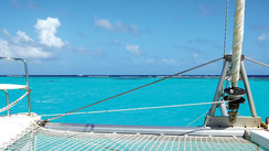
The Unmissable Grenadines…
The Bahamas, 700 islands just for you…
The dream of the Abacos
The turquoise waters of Belize
The legendary British Virgin Islands
Cuba, from Colomb to Hemingway...
Subscribe and get 8 issues a yearfor just $39.90
subscribe
For all used-boats for sale
Classified ads
View classified ads
CATANA 471 Ocean Class - v. owner (Refit 2025-26) Transat ready
- Location :
- Marseille, France
- Year :
- 2004
Swiss Katamaran 55 (2012 • Refit 2022/23)
- Location :
- Mallorca, Spain
- Year :
- 2012
What readers think
Post a comment
No comments to show.