‹ Back destination

U.S. Virgin Islands - America with a Caribbean flavor

Representing a dream destination for chartering a multihull, the Virgin Islands offer a territory as vast as it is varied. History saw their ownership scattered among various nations, including Great Britain, Spain, the Netherlands, Denmark and the United States. Although the latter is not necessarily the most famous, it does offer an ideal playground for cruising and relaxing.

Geographical location


The U.S. Virgin Islands are located in the Caribbean Sea about 32 miles east of Puerto Rico and are considered part of the Greater Antilles. They are in fact the third part of the Virgin Islands - along with the British Virgin Islands and the Spanish Virgin Islands – though the latter are actually part of the US territory of Puerto Rico. While the British side is a little more popular, the two nations are separated only by a narrow channel northeast of St. John.
The territory of interest here is made up of three main islands, St. John to the north, St. Thomas to the west of St. John and St. Croix some 30 nautical miles to the south. In addition, there are about 50 smaller islands and islets.
Previously owned by Denmark, the USVI were purchased by the United States in 1917 for strategic reasons. Although part of the USA, the USVI is an unincorporated territory, meaning it is not a state.
Of volcanic origin, this archipelago offers a fairly mountainous terrain covered by lush vegetation, with the highest point being Crown Mountain (474 m / 1,555 ft) on the island of St. Thomas. The Virgin Islands are also renowned for their countless coves, ideal for anchoring, their white sandy beaches and crystal-clear waters, where colorful wildlife thrives.
Another interesting feature is the natural park that covers around 60% of St. John’s Island, as well as Hassel Island and a few other islets. This allows you to enjoy unspoiled nature and absolutely bucolic hiking trails.
Numerous beaches and a few port towns also make it possible to disembark and explore the inland, where a few historic buildings drown in the midst of very Caribbean architecture. The population is predominantly black, with Hispanics accounting for a sizeable proportion. Generally speaking, the islands are sparsely populated, providing a relaxing atmosphere.
Tourism is unsurprisingly the islands’ main economic resource, with around 2 million visitors a year, including cruisers.

Sailing


As far as sailing is concerned, the islands are a charterer’s paradise, with numerous charter agencies and a fleet made up largely of multihulls. However, apart from a few very touristy spots, the coves are not overcrowded, and you can always enjoy a quiet anchorage to admire the sunset (with the prevailing easterly trade winds, the best anchorages face west). The clear, calm waters are also ideal for water sports activities such as water- skiing, kitesurfing, paddle-boarding and of course snorkeling.
In terms of infrastructure, marinas are virtually non-existent outside the main towns. So it’s a good idea to plan for all your provisioning needs, including water and fuel. Because of the layout of the area, a dinghy is absolutely essential, whether you’re going to the beach or the local restaurant.
Last but not least, most of the time you’ll be sailing with an easterly wind - sometimes a strong one - which is something to keep in mind when planning your itinerary.

Most sailing starts from Charlotte Amalie, the capital of St. Thomas, or from St. John. Here you’ll find well-equipped marinas and the stores you need for provisioning.
From there, the possibilities are almost endless, depending on your wishes, the time available and the weather conditions.
Departing from Charlotte Amalie and with a strong easterly wind, you’ll want to head for the south or west coast to find shelter.

Weather


The climate in the U.S. Virgin Islands is relatively warm, with a minimum of 22°C (71° F) and temperatures rising to around 35°C (95° F) in the summer months. The average temperature is around 27°C (81° F). The islands are also known for their fairly dense cloud cover. Precipitation is frequent, but not necessarily long-lasting, with the heaviest rainfall between August and November. The climate is also very humid, with humidity levels of 78% or more between March and January.
To temper this and keep our multihulls moving, there is typically no shortage of breeze. Mainly easterly, it averages between 11 and 16 knots throughout the year, which means that we look for anchorages on the west coast of each island or in well-protected coves.
The USVI is also a great spot for water sports, as the water temperature rarely drops below 26°C (78° F) and can rise to 29 or 30°C (86° F). The archipelago is bathed in clear turquoise waters, particularly in the well-sheltered coves.
The best time of year to sail the U.S. Virgin Islands is from December to April. Hurricane season starts in June and ends in October.
Itinerary
Day 1 - Charlotte Amalie (Yacht Haven Grande) - Christmas Cove (8 nm)
After victualing, head south, then southeast to Christmas Cove, a bay sheltered by Great St. James. An ideal spot for snorkeling, with abundant wildlife. Anchoring is only permitted where there are no seagrass beds or coral. This is also where you’ll find Pizza Pi, a sailboat converted into a pizzeria.
Day 2 - Christmas Cove - Caneel Bay (5 nm)
Head a little further north to reach St. John and your first stopover in a bay with a lovely white-sand beach. To spend the night, use a National Park Service (NPS) mooring buoy, a white ball with a blue stripe, for $26 cash per night. From here, it’s also easy to get to Cruz Bay, St. John’s main town.
Day 3 - Caneel Bay - Maho Bay (5 nm)
A quick hop is all it takes to find yourself in a large, fairly deep bay. Surrounded by fairly high hills, it offers excellent shelter from easterly winds. There are some lovely beaches, and the absence of city lights makes for excellent stargazing.
Day 4 - Maho Bay - Leinster Bay (6 nm)
Heading north again, leave Mary Point to starboard, then east along the channel between the US and British Virgin Islands. Not recommended in strong winds, Leinster Bay is considered the island’s number one snorkeling spot. To spend the night, use an NPS mooring buoy - again for $26.
Day 5 - Leinster Bay - Hansen Bay (10 nm)
Head east between USVI and BVI, then south to round Privateer Point, St. John’s most easterly point, then Red Point before heading north along Long Bay to Hansen Bay. This well-protected bay is ideal for swimming. Just across from the anchorage is Miss Lucy, a restaurant serving local cuisine, and you can push on a little further to reach Salt Pond Beach, a dreamy, well-sheltered beach with white sand, and the Ram Head trail, which takes you to the top of a hill with a panoramic view of St. John and the BVI.
Day 6 - Hansen Bay - Magens Bay (23 nm)
Head south, then northwest for a superb sail along the south coast of St. John, then northeast of St. Thomas. Once past Thatch Cay, the sea can get a little rough at times, as it’s a little more exposed. Leaving Hans Lollik to starboard, round Picara Point to enter the superb Magens Bay. Very popular, this bay is also very busy, but you’ll have the evening and early morning to enjoy it. Tip: if you want to save water, the beach has showers.
Day 7 - Magens Bay - Charlotte Amalie (25 nm)
Last leg of the trip, sailing along the magnificent but very rocky north side of St. Thomas. Once past Salt Cay, turn south, leaving Mermaid’s Chair, a pretty little beach, on your port side. Shortly after David Point, we turn east to head for Charlotte Amalie. Slip between the airport and Water Island until you reach Charlotte Amalie Bay, either slipping in between St. Thomas and Hassel Island, or rounding the latter.
With a few extra days...
If you have a few more days, you can head for St. Croix, around 36 miles from St. Thomas. The sea is often choppy, with swells of 1.5 to 2 m (5 to 6 ft), so be sure to check the weather forecast. The island also offers far less shelter than St. Thomas or St. John. One exception to the rule: Christiansted Bay is both vast and well sheltered.

Things to know


Population : 105,870 (2021) St. Thomas (51,181), St. John (4,170), St. Croix (50,600)

Area: 346.4 km² (133.7 sq mi)

Languages: English - Spanish is also widely spoken

Time zone: UTC- 4

Currency: Of course, the US dollar is used, with a few ATMs in Charlotte Amalie on St. Thomas, Cruz Bay on St. John and Christiansted or Frederiksted on St. Croix.

Getting there: The USVI has two main international airports, Cyril E. King Airport (STT) on St. Thomas and St. Croix’s Henry Rohlsen Airport (STX) on St. Croix.
To get from one island to the other, there are several options. You can travel by air with a scheduled airline, take a seaplane for an exciting experience or take a ferry.

Formalities: As this is a U.S. territory, non-Americans must comply with the same requirements as at any point of entry to the U.S., i.e. a passport and an ESTA or visa, depending on your country of origin.

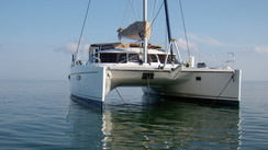
Charter companies: The USVI has a large number of charter companies, and here are just a few of them.
The Moorings, Dream Yacht Worldwide, Virgin Islands Yacht Charters, Anchors Away, Epic Yacht Charters, Happy Island Charters etc.

Transport on the islands: There are a few bus routes, as well as the traditional cabs and the famous Safari Cabs, pick-up trucks whose rear end has been fitted out to carry passengers - thrills and bumps guaranteed...
There are also a few water taxis, handy for running errands and returning to your multihull.

Charlotte Amalie Bay, the capital of  the USVI, offers a sheltered anchorage for the many multihulls passing through.
Charlotte Amalie Bay, the capital of the USVI, offers a sheltered anchorage for the many multihulls passing through.
Thanks to a warm, humid climate, the vegetation is lush,  whatever the time of year.
Thanks to a warm, humid climate, the vegetation is lush, whatever the time of year.
Lindquist Beach, just east of St. Thomas, is one of the archipelago’s most famous.
In some bays, anchoring is forbidden, so tie up to a buoy for less than $30  a night.
In some bays, anchoring is forbidden, so tie up to a buoy for less than $30 a night.
The cove of Cruz Bay, St John’s main town, offers a heavenly backdrop and allows you to reach the beach with a dinghy.
Numerous trails, often accessible from the beach, allow you to stretch your legs and enjoy the vegetation and the panorama.
As everywhere in the Caribbean, color is all over, from license plates to signs.
The Virgin Islands are home to a number of endemic species, such as these melocactus.
The Virgin Islands are home to a number of endemic species, such as these melocactus..

Share this article