


Issue #: 165
Published: May / June 2019
- Price per issue - digital : 6.20€Digital magazine
- Price per issue - print : 8.50€Print magazine
- Access to Multihulls World digital archives Digital archives
The Cocos Keeling atoll, or rather atolls because there are really two of them, are around 1000 km (540nm) to the west-south-west of Christmas Island. After three days at sea, having left behind the island of phosphates and red crabs, a new day dawned over the Indian Ocean.
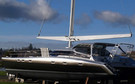
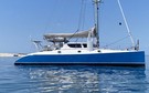
Here are Jangada's adventures in the Cocos-Keelings!
Published 22/03/2019
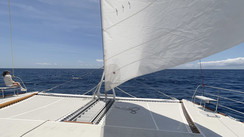
During the night we had slowed our pace and were sitting around a dozen miles from the South Cocos Keeling passage, when the daylight suddenly illuminated the ocean. North Cocos Keeling, which is uninhabited is not accessible to boats. The island has no lagoon or channel, just a coral reef which rings the island and against which the sea breaks violently. There are no sheltered anchorages, and since it became a designated Australian National Park in 1995, landing on the island has been forbidden. However, South Cocos is a different story: a huge lagoon, 27 islands and islets, 2 wide passages and excellent anchorage which is well-sheltered from the tradewinds by Direction Island, which is now deserted. The only downside is that the water soon becomes very shallow, and means that sailing around the lagoon for larger boats is not possible. There is a launch which connects Home Island to the east and West Island. Only small draught vessels can head out towards the center of the lagoon.
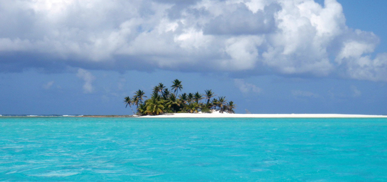
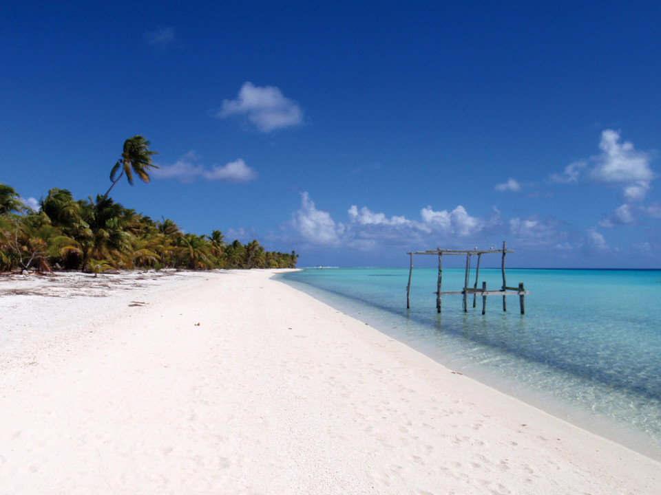
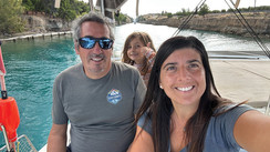
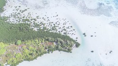
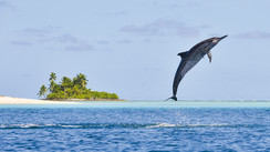
Passing boats congregate in the Direction Island anchorage. Despite this it is one of the loveliest that we have encountered on our round the world trip. 2 or 3 miles to the south is Home Island, where the administrative authorities are based, and where there is a post office, an internet service, and a grocery store with the most expensive prices that we ever saw ($10 Australian for a kilo (2lbs) of potatoes). You need to use your dinghy to get ashore. Beware of the coral which is all over the place. At first light I looked across the somber horizon for the line of coconut palms on South Cocos. I first made out Home Island, two points to port, and then Direction Island. Even in these days of electronic navigation, GPS and the Maxsea software, I still find the sight of an island emerging from the sea to be quite magical, like a recurring dream, and these are moments which I cherish. Situated 12° south of the equator, the Cocos Keelings are affected by the Indian Ocean monsoons. There is a north-west monsoon from January to May and south-east Trade Winds for the rest of the year. Since 1984 the islands have been an external Australian Territory, despite being almost 2800 kms (1,500nm) from the city of Perth on the Australian west coast, from where there is a weekly flight. There is another air route, mainly used by the population of Asian (mainly Malaysian) origin, and Europeans, which links the small atoll to Singapore. I have in front of me a map of the sea bed in this part of the Indian Ocean. You'd think that we were flying over the Alps! The two Cocos Keeling atolls formed at the summits of two former volcanoes, now submerged and which rise on average 5000 meters (16,400 feet) above the ocean floor. These two huge underwater mountains are linked under the water by a narrow base, at a depth of 7 to 800 meters (2,300 to 2,600 feet). The North Cocos Atoll, which is surrounded by an uninterrupted coral reef, is made up of just one island measuring 2 kms by 1.3km (1.25 x 0.8 miles) and only reaches an altitude of 5m above sea level. By contrast, South Cocos, 12 miles further south is a circular atoll made up of more than twenty islands enclosing a large lagoon (17km by 11km / 10.5 x 7 miles) which links to the sea through two wide passages and a number of false passages where the ocean water gets in at high tide over the reef.
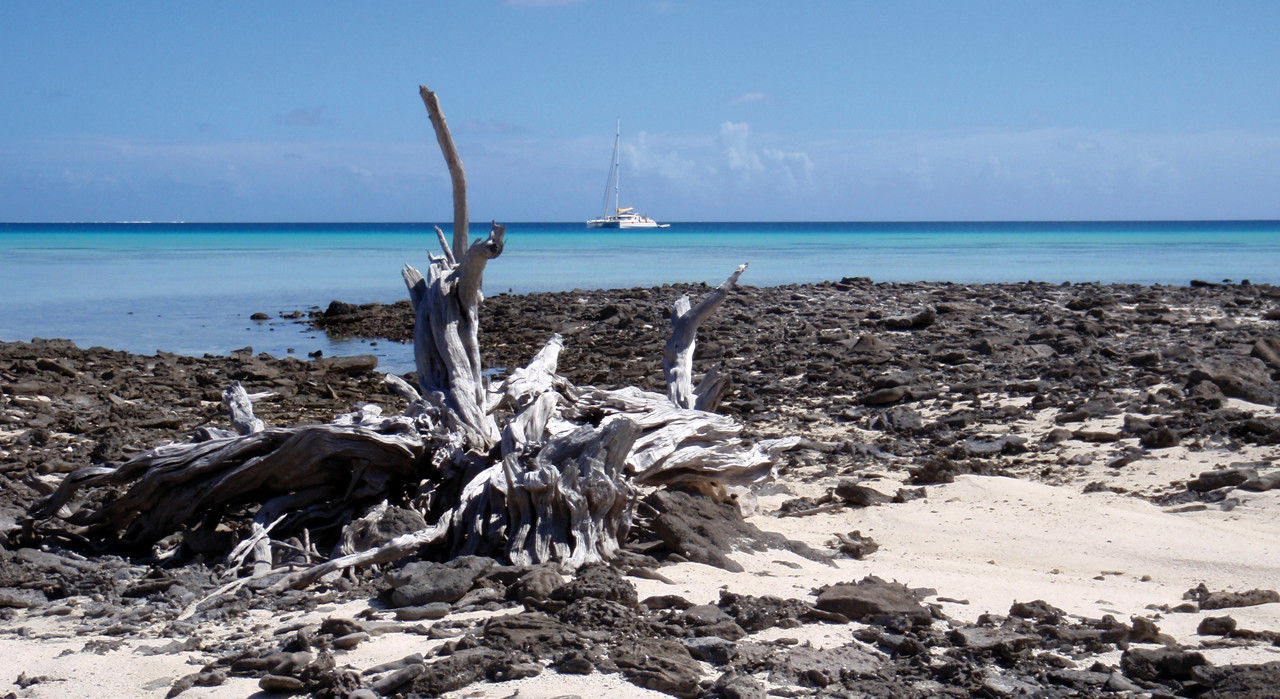
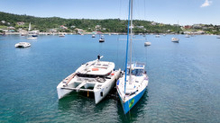
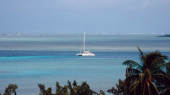
We approached the southern Cocos atoll from the east, heading for Horsburgh Island which forms an extension of the atoll to the north-west, guarding the main passage. I looked out with my binoculars for two markers which indicated the particularly wide passage. It was the morning of the 28th August, and our goal was the Port-Refuge anchorage, sheltered by Direction Island. We lowered the sails and picked our way between the clumps of coral towards the yellow quarantine buoy. The swell of the open water was gone, and the lagoon's turquoise waters were unbelievably clear. You would have said that the water was 2m (6') deep when in fact it was 10 or 12 (30 or 40 feet)! The anchor dropped onto the coral sand. There was a good hold in the 4m (13') of water, and we were about 50m (170 feet) from the beach which was shaded by thousands of coconut palms. these must have contributed to the naming of this little archipelago. Welcome to one of the most beautiful locations for "yachties"!
What really grabbed my attention in the Cocos was the amazing history of this little group of islands. It all started in 1609, when the British captain William Keeling, returning to faraway England from Bantam on the island of Java, passed by and discovered the islands. For some unknown reason, but probably to keep his discovery under wraps, he didn't mention the islands in his log. However, his crew did talk in the taverns of London, which led to him giving his name to those briefly seen islands in the Indian Ocean islands much later on. From 1622 the islands began to appear on nautical charts, under the name Cocos Islands. In 1703 the English hydrographer Thornton, used the name Keeling Islands in his work entitled "Oriental Navigation". In 1805, another English hydrographer with a rather overinflated ego, James Horsburgh, used the title Cocos Keeling Islands for the first time in his "Sailing Directory". He was probably rather jealous of those sailors who had discovered far flung islands and had the privilege of naming them after themselves. He decided to give his name to the island to the north-west of the atoll, which separates the two passages, despite never leaving his London office!
From that day forward, James Horsburgh would never be forgotten! The islands were known about from the beginning of the 17th century. However, despite their position on the trade route between southern Africa and the Far East, no effort was made to colonize the islands for over 200 years. It wasn't until 1825 that the islands' history began to get interesting. Things happened quickly that year. Firstly, there was a tragic shipwreck of the brig "Mauritius" on the coral reef. The captain Le Cour instructed his men to live for several weeks on Direction Island. On the 24th November 1825, Captain Driscoll on "Lonarch" made a stopover in the lagoon and noted the presence of the wreck of the "Mauritius" and that the crew had been rescued. A few days later, on the 6th December, a small craft the "Borneo", belonging to the company John & Joseph Hare and Co., under the command of a certain John Clunies-Ross from the village of Weisdale in the Shetland Islands, dropped anchor in Port-Refuge in the lee of Direction Island. That name-Clunies-Ross- would forever influence the history of the Cocos. He sailed under the English ensign too, but the shipowner, Alexander Hare had ordered him to look into the possibility of setting up an office on Christmas Island for the Hare trading and maritime transport company. The bad weather and difficult anchorages at Christmas Island, led Clunies-Ross to the Cocos. The Scottish sailor went briefly on land. He checked out the main passage and cleared two patches of land, on Horsburgh and Direction Island, where he planted cereals and vegetables. Then he set out to sea again and wrote his report. In the May of the following year, Alexander Hare set out for the Cocos on board the Hippomenes, captained by Clunies-Ross. There were a hundred men and women on board sharing the adventure. The exact truth isn't clear, but it would appear that Alexander didn't have a problem with polygamy!
Let's just say that he had chosen a large and varied entourage! At least that is what a certain Joshua Slocum a legendary skipper, originally from Boston would relate 70 years later. On board there were also animals and plants, seeds and lots of other material. Alexander Hare put his main base on Home island and secondary camps on the other islands. Most of the pioneers on the Cocos were Malaysians. However, there were also Chinese, Indians and Papuans. They came from Bali, the Sunda Islands, Sumbawa, Timor, Sumatra, Malacca, Penang and Batavia. They were mainly Muslim and spoke Malay. A new era was beginning on the Cocos. Joshua Slocum (the first man to sail alone around the world at the end of the 19th century on board his 11.20m (36'9") "Spray"), tells us after his first stopover on the Cocos in July and August 1897, that Alexander Hare had landed on the atoll with 40 Malaysian women. A veritable harem. Hare was rich, and could have led the high life in London. However, he had been governor of a British colony on Borneo and had kept the taste for the pioneer life, far from the strictures of the Empire…The following year the captain John Clunies-Ross returned to the Cocos-Keeling. This time he wasn't alone either. He brought part of his Scottish family with him: his wife, his mother-in -law Mrs. Dymoke, some staff and a crew of 8 solid Scottish sailors. He also had the idea of setting himself up in the islands. To start with on South Island, or Pulu Atas in Malay. He facilitated the access for his craft by digging a channel through the coral. However, his relations with Hare quickly headed south. The two communities were now rivals, with a conflict of interest. However, the two men were very different, and they had different ways of operating. Hare had control of the atoll and had no plans to leave it for the newcomers. In 1829, the population of Cocos Keeling was 175: 20 Europeans and 155 Asians and Africans. From 1831, the rivalry between the two men took a fresh turn. Hare holed up with his wives on a breathtaking little island just north of Home Island, known since that time as Prison Island. Of course, it is nothing like a prison. The little island is an earthly paradise. It's still the same today, even though it has diminished in size. The channel between the two Islands is narrow and shallow, and Clunies-Ross's 8 Scottish sailors had big boots… Hare soon became desperate. Slocum picks up the story:
"He, (Hare) tried to calm things down by offering rum and food, but it simply had the opposite effect to what he had hoped for. The next day, Hare, who was no longer on speaking terms with the Captain (Clunies-Ross), sent the following letter:
- " My dear Ross, I had hoped that by sending rum and roast pigs to your sailors that they wouldn't come any nearer to my little garden"
In reply, an indignant captain wrote from the center of the island where he was based:
"Oh! Over there on Prison Island! Hare! Did you really think that you could turn a sailors head with rum and roast pig"?
Eventually, the women left Prison Island and sought refuge with Ross. Hare left for Batavia where he died."
John Clunies-Ross now had carte blanche to do as he wished. He soon became the uncontested master of the islands, and for decades, the Clunies-Ross family was instrumental in their amazing history, lost in the middle of the ocean.
In 1836, a scientist who would soon be known the world over stopped off in the Cocos. He was still young, and didn't yet sport the long, white, wise man's beard for which he would become known later on. However, he was already showing an amazing gift for observing all facets of the natural world. He had been sent out as a biologist and naturalist on board one of His Majesty's ships, The Beagle, which was making a scientific tour of the globe. His name was Darwin. Charles Darwin. Fitzroy and Darwin were in the Cocos from the 1st to the 12th April 1836, before moving on to Mauritius. Darwin never missed out on an occasion to weigh up what he saw before him. In the Cocos he was confronted with an atoll that was typical of those in tropical seas. His brilliant mind began to wonder. Nothing could stop him. He observed and then considered. How could a geological formation like this, that he had already encountered in the Pacific have come about? Captain Fitzroy and the crew of The Beagle left the lagoon to carry out bathymetric surveys. At only 2200 yards (2011 meters) from the shore of South Cocos, The Beagle's sounding line, which was 7200 feet (2194 meters) long, had not reached the bottom. Darwin deduced that the atoll was in fact at the top of an underwater mountain with very steep slopes. He had previously observed the presence of fossilized corals in the interior of certain islands and in certain landlocked mountains. It was after his stay on the Cocos and his return to England that in 1842 Darwin published his study in coral reef formations. In his study he developed the first theory relating to the formation of atolls in warm seas. His theory was later proved to be correct, and still holds to this day. Well done Charles!
Three years after settling on Home island, John Clunies-Ross's enterprise was booming. He exported large amounts of coconuts, copra and oil. Their cereal, fruit and vegetable production wasn't just enough to feed the small community, but also allowed them to make money by selling the excess to the crews of whaling and seal ships who were now stopping off in the Cocos to stock up on supplies when heading back from the south. In 1841, John Clunies-Ross's eldest son married a Javan woman, and came back to live on the Cocos. In 1854, the pioneer of the dynasty (Ross I), died in his islands. In less than 20 years, he had built up a small feudal kingdom, which would stay in his family for 150 years! In 1857 the Cocos became part of the British Empire, and John-George Ross (Ross II) became the governor of the archipelago on behalf of the crown. The coconut groves had never been so productive, but in 1862, a cyclone decimated the islands. John-George interrupted the studies of George, the eldest of his seven children in England, and asked him to come back and help with the reconstruction of the family business. In 1871, the third "King of the Cocos" George Clunies-Ross (Ross III) succeeded his father after the former's death.
In 1878, the Cocos came under the administrative control of the British Governor of Ceylon. In practice, this changed very little for the inhabitants of these little islands lost in the middle of the ocean. However, in 1886, the grandson of the Scottish Clunies-Ross pulled off a great coup. Queen Victoria herself handed over the exclusive ownership of the Cocos Islands, in perpetuity, to the Clunies-Ross family! From 1888, George designed and built a large family home by the water on Home island: Oceania House. In 1893 the family moved in. In 1897 the Clunies-Ross family began a partnership exploiting the phosphates on Christmas Island. This also happened to be the year that the first solo round the world trip was carried out under sail by a captain of the Merchant Navy. A certain Joshua Slocum, who stopped over in the Cocos Keelings on board "Spray".
He wrote: "If paradise exists on earth, then it is surely the Keelings. Since Hare left, there have never been any disputes. The Ross family have always treated the indigenous peoples as though they were part of their family.".
George Clunies-Ross died in 1910 and was replaced by his son John Sidney, known as Ross IV. The story continued…
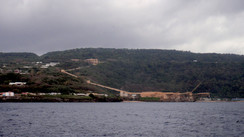
In 1925, John Sidney Clunies-Ross, aged 56, married the young 22-year-old Rose Nash in London. In 1940 he came back to live on the atoll, leaving his wife and children in the UK. In 1941 the British installed canons on Horsburgh island to protect the Coco's radio station. The archipelago was bombed by the Japanese in 1942 and 1944. John Sidney died in 1944 and the islands were placed under the authority of a military governor. Up to 7,000 Commonwealth troops were stationed on West island from 1944. They built a military airport, and the airline Qantas began to use it commercially from 1951. The archipelago had never been so populous: nearly 10,000 people were living there! In 1946, Rose, the widow of John Sidney came back to live on the Cocos with their children. Aged 18, her eldest son John Cecil Clunies-Ross (Ross V) took over his father's succession.in 1952, Qantas opened up a regular service to South Africa with a stopover on the Cocos, and a young Queen Elizabeth visited the atoll in 1954. This probably had nothing to do with the fact that in 1955 control of the Islands was transferred from the British colony Singapore to Australia. In 1968 the Cyclone Doreen devastated the islands, which forced John Cecil Clunies-Ross to move to Australia and to get close to the Aussie government.
Finally, in 1978, after several commissions had studied the situation, the Australian government negotiated the purchase of the Cocos Islands. They paid $6,250,000, and the Clunies-Ross family kept Oceania House and some land on Home Island. The next year, an Island Assembly was created. However, relations with the surviving members of the Ross dynasty went from bad to worse. In 1983 the Australian government invited John Cecil and his family to leave the Cocos. They finally left in 1986 after their shipping company went bust and Oceania House was purchased by the Australian government. Already in 1984, the islanders had voted by a large majority to integrate politically, socially and economically with the Australian state. In 1993, the Cocos (Keeling) Shire Council (the island's assembly), voted to rent out North Cocos to the Australian government to create a National park. Pulu Keeling National Park officially opened in 1995. Today, the direct descendants of John Clunies-Ross live simply in Perth, Western Australia, with the exception of John George, the son of John Cecil, who still lives in the Cocos, on West island, where he has a grocery store. So the Clunies-Ross family were the only owners of the Cocos from 1886 until 1978, but the hold of the Scottish dynasty over these islands blessed with white sand and coconut palms, and surrounded by coral reefs, lasted for 150 years! What a story! I would have enjoyed taking tea in the shade of the palm trees with John Clunies-Ross, the pioneer! What a guy!
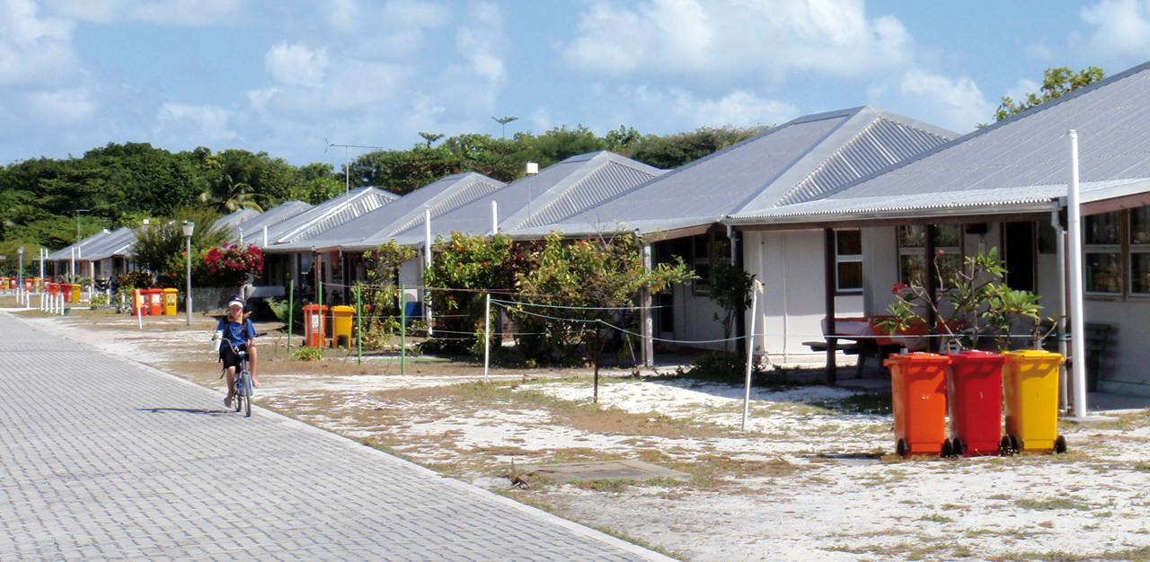
The archipelago's integration into the Australian state allowed the small island community to catch up somewhat in terms of public infrastructure and education. Today, the Cocos residents are Australian citizens. The population is around 650, made up of 70% Malaysians, 18% Australians and 12% British. The Brits and Australians live mainly on west Island, close to the airport, whereas the Malaysians live mainly on Home Island, in the Kampong (village in Malay). The first group are mainly Anglican Christians and the second Muslim. Neither community seemed to be too concerned about working… On the Cocos today, the pace of life is slow, in the shadow of the rich and powerful Australia…
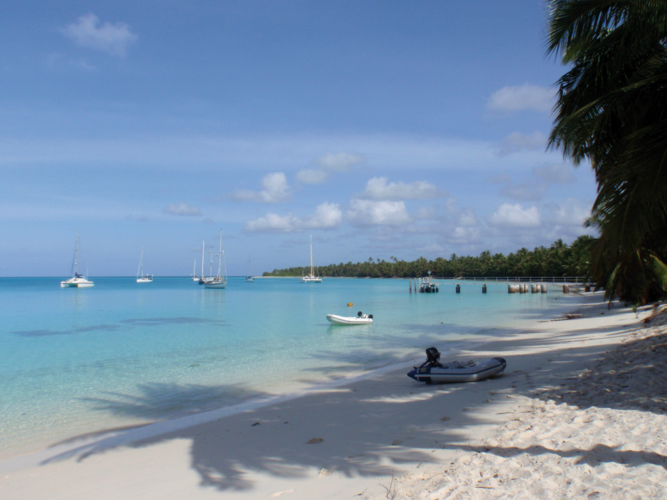
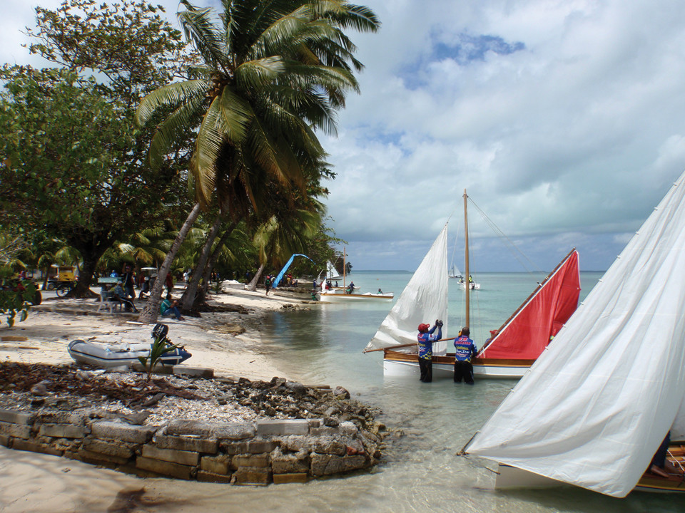
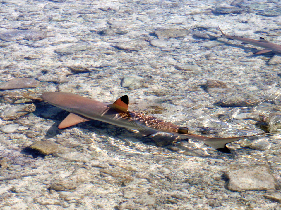
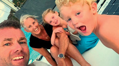
The copper-skinned official who came out to visit Jangada in her Direction Island anchorage, arrived from the Kampong in a huge, powerful semi-rigid inflatable. He was accompanied by a veiled woman. The man was pleasant and affable. He was wearing an Australian Customs vest and a Federal Police hat. He welcomed us to the islands and gave us a few helpful tips for our stay. He took the paperwork and was soon back from Home Island. We headed to the immaculate beach, shaded by hundreds of coconut palms for our first swim. Today, Direction Island is pretty much given over to crews of boats making a stopover in the islands. There's a double hammock, an old wooden chair, a few tables and a diving board. We allowed our boat to drift in the "rip", a kind of false passage which at high tide connects with the sea to the east of the lagoon. The current which passes over the barrier reef takes us quickly to a 15-meter-deep (50 feet) fault in the coral which is full of fish. Through our masks we could see large trevally, groupers, and immobile, sleepy reef sharks which were lying on the sandy bottom. We carefully passed over them and headed to the calm waters of the lagoon. Under the water there were vestiges of a slipway which was probably used to get the boats out of the water when they needed careening. There is nothing left of the old Cocos islands radio station apart from a simple sign marked "Cable Station". Some of the trees bear the hallmarks of previous crews that have stayed over here, with drawings, paintings or even pieces of wood attached to the trunks of the coconut palms. I suggested to the children that we should leave a souvenir of Jangada's stopover. They liked the idea. I dug out a circular piece of plywood for them and they headed to the shore of Direction Island looking for a common article which we see everywhere: brightly colored flip-flops! Washed up on a beach after drifting for ages, and always as a single, never a pair! However, they have an amazing "floatability", and the swell and the wind have brought them from far off beaches in Australia and Indonesia before washing them up on the coral in the Cocos Islands. Made from a cheap and practically indestructible product, their presence in these places should make us reflect on the human race's ability to deface the wildest natural spaces on the planet. Adélie and Marin came back to our little camp at Port Refuge with an armful of the most fluorescent color they could find, labelled "High Seas". The cutting up can begin. Each member of the crew will be represented on the eventual collage. When the masterpiece is finished, I drill two holes and fix it to the trunk of the coconut palm.
How long will our children's artwork, proof of our passage via the Cocos Islands, stay around for future visitors? If you're ever in the area… a


What readers think
Post a comment
No comments to show.