

Issue #: 186
Published: November / December 2022
- Price per issue - digital : 6.20€Digital magazine
- Price per issue - print : 10.90€Print magazine
- Access to Multihulls World digital archives Digital archives
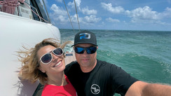
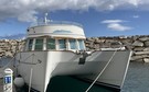
Our readers know Jean-Pierre Schiavi and his faithful Lagoon 52S Cat’leya very well: the crew has been featured in many Postcards in this magazine and he also wrote about a wonderful cruise on the US east coast - see MW170. A lot of water has flowed under the bridgedeck since then, and we are now ready to discover the Pacific Ocean and more precisely the mysterious South Island of New Zealand and its Fiordland, at the southern end of the country.
Published 23/09/2022
Subscribers Only3,000 nautical miles, 3 months of sailing... Destination? Fiordland! It has been more than 2 years since Cat’leya took refuge in New Zealand... From Auckland to Cape Kari Kari, we discovered a magnificent coastline and an exceptional sailing environment. The trips ashore to Rotorua, New Plymouth and so many others gave me another insight into this green country, but the story couldn’t stop there... The South Island is a complete mystery to me, and being a curious person, I have read about journeys to this other New Zealand of which the gem is the Fiordland. It is a very isolated region, located in the southeast of the South Island of New Zealand. The appeal of Fiordland comes from a combination of factors - a wild and unspoilt environment, magnificent landscapes where the mountains meet the sea, a rich history linked to the exploits of Captain Cook and other explorers, seal and whale hunters and the era of the gold and coal mines... Of course, the sailing conditions in these southern latitudes are much more rigorous than those of Sydney, an easy reference point in the southern hemisphere. We go from 33° South to 45°. Yes, here we are between the Roaring Forties and the Furious Fifties, but it is a new adventure that I decided to experience and one that I have been preparing for several months. The El Niño/La Niña oscillation has a considerable effect on the weather in this area too.
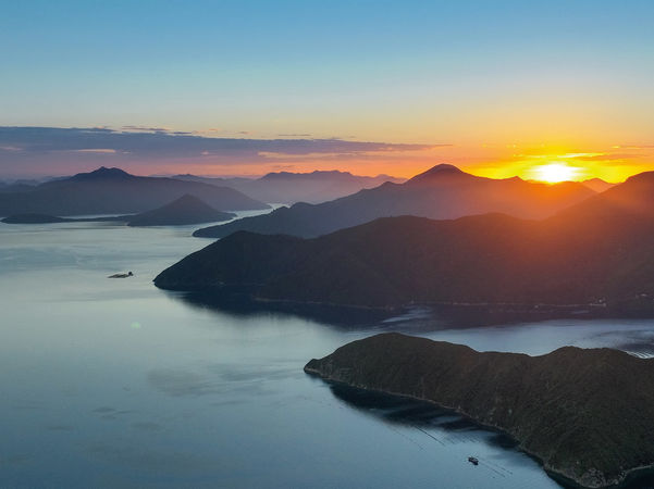
An unforgettable sunset from Port Ligart
During El Niño periods, the ocean is colder in the western South Pacific. Low pressure activity is weak while high pressure dominates the central and northern Tasman Sea. New Zealand is frequently affected by cold fronts coming from the Tasman Sea on southwest winds. North Island is dominated by high pressure while South Island is windier and temperatures are lower. Conversely, during La Niña events, the ocean is warmer in the Coral Sea and generally the tropical west of the South Pacific; this warmth leads to the formation of storms from the northern Tasman Sea to southwest Fiji moving south or southeast towards the North Island while high pressure settles over the South Island. My advice? During La Niña, go to South Island, during El Niño spend the summer in North Island. 2022 was a predominantly La Niña year and we would see great weather, few gales and only 6 days of rain, a real bonus when visiting Fiordland!
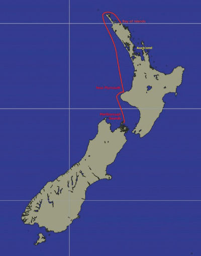
The first question that arises when touring an island is to know which direction to take... The western route (counter-clockwise), although much shorter in distance, offers very little shelter. The south-west winds and the consequent swell from the fifties latitudes make the eastern coastal route of New Zealand more attractive (clockwise). This is true until Stewart Island; then joining Fiordland by the Foveaux Strait (between the South Island and Stewart Island) is another story.... The Southern Alps also have a major influence ...


What readers think
Post a comment
No comments to show.