


Issue #: 149
Published: September / October 2016
- Price per issue - digital : 5.40€Digital magazine
- Price per issue - print : 6.20€Print magazine
- Access to Multihulls World digital archives Digital archives
We catch up with the crew of Jangada during their stopover in New Zealand, halfway through their trip around the world…
Published 01/08/2016
With the boat well-sheltered on the hard, we have become land-lubbers again. Backpacks, sleeping bags, tents, gas stove, water bottles, headlamps… Late December, we set off on State Highway One, which runs from north to south of both islands of New Zealand. The V8 motor of our secondhand 4x4 purred along smoothly: if you fed it 18 liters of gas every 100 km, it pushed you along nicely! With our Interislander ferry tickets in hand, we wandered around the downtown area of Wellington, New Zealand‘s capital. It is one of the windiest cities on Earth, thanks to its location in the Cook Straits, an often stormy area which separates North Island from South. At night the sky was filling with big dark clouds, pushed along by a rising wind. The crossing, which normally takes a little over 3 hours, took five! The ferry had to fight against the gale which came up just before we set off. We disembarked, tired, around 5 in the morning at Picton, a small town sheltered from the sea by a deep fjord, Queen Charlotte Sound. The gusts were shrieking at 40 or 50 knots, with torrential rain hammering on the roof of the Land Rover when we parked up on a small headland on the road to Havelock. Wow! At daybreak the storm was dispersing, but the overnight rain had transformed the streams into torrents. Trees uprooted, roads flooded and landslides. Later on, the first rays of sun reappeared over Blenheim, the wine capital of New Zealand.
We didn’t know it, but New Zealand, or at least South Island, could easily be mistaken for the green pastures of France! I was going to enjoy this place! The trouble is we French weren’t very good at managing our empire. Okay, time has moved on. But the British, again and again, got the better of us! Not much of course, but enough to leave a bitter taste. And always cunningly… Those double-crossing Brits… [note from the translator: there are two sides to every story…] France’s Captain Langlois, who regularly anchored at Akaroa, wanted to establish a colony there. During 1838, he negotiated the purchase of 30,000 acres of Maori land for 1,000 francs. He decided to return to France, to seek the backing of King Louis-Philippe’s government, which he obtained. As well as funds and settlers. He wanted to colonize New Zealand! On board his ship, the Comte de Paris, 57 emigrants joined the adventure. A few weeks later, Louis-Philippe dispatched the warship Aube, under the command of Charles Lavaud, France’s official representative. But all this took time, and on the other side of the world… the British, having got wind of this, sped up their negotiations with the Maoris in North Island. In February 1840, the treaty of Waitangi was signed. And on June 17th, British sovereignty was extended to South Island… By August 1840, when the Comte de Paris and her emigrants entered the bay at Akaroa, it was a huge letdown: the Union Jack had already been fluttering in the breeze for eight days! Those double-crossing Brits, I tell you…
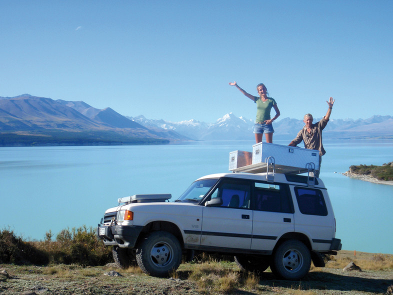
A long vacation in New Zealand for the staff of Jangada, on board their Land Rover in front of a snowy Mount Cook…
New Zealand flying the tricolor? The dream stopped there. All that remains of this aborted attempt is a small French cemetery and a few streets names: rue Balguerie, rue Benoit, rue Pompallier and rue Lavaud.
Among the British emigrants to arrive at Akaroa in the following years was the Worsley family. One of them, Frank Worsley, became a great sailor: he was later to become Captain of the Endurance, Ernest Shackleton’s ship, during her famous (and dramatic) 1914-1916 expedition in the Weddel Sea. Among the flowering pohutukawa trees close to the wharf at Akaroa I found a bust of Captain Worsley. Respect to him.
The evening of December 31st, it was chilly in our tent at the campsite overlooking French Bay. We opened a nice bottle of Kiwi wine, but one with a French grape variety! Raising my glass, I thought of family, and my eldest back home, so far away, and of our children on North Island, and of our friends. I also toasted Worsley, Captain of the Endurance, and lastly… the sometimes random course of history!
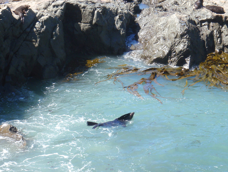
On the east coast at Kaikoura, the sealions are no longer hunted by the sealing ships…
The Central Otago region, in the southern part of New Zealand’s South Island, is possibly my favorite in this beautiful country. Here we found majestic countryside which extended beyond the horizon, and rolling green hills as far as the eye could see. Sometimes, the landscape was drier, more rugged, the basalt rocks of ancient natural disasters dotted with dry grass, battered by the deep depressions of the Roaring Forties. Dwellings are rare, and people were few and far between. Old villages, built during the gold rush, today lie abandoned. There are definitely more sheep, cows and deer in Central Otago than people. The air here is very pure, and nature dominates. I love it! But I’m sad to say that one of the noticeable things about great places, far from the bright lights of the city, is that even though people are rare here, they have had their effect on the environment. In short, they have tarnished it, because they don’t know how to do otherwise, unfortunately.
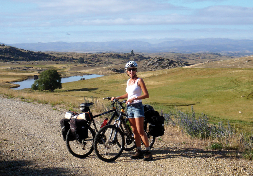
After the catamaran and the Land Rover, we continue our voyage by bike on the Otago Central Rail Trail…
One episode in particular shaped the history of Otago: the gold rush of the 1860s. From Dunedin, Otago’s main town, whose port largely contributed to the rapid but relatively short lived development of the region at the end of the 19th century, a single track railroad, the Central Otago Railway, penetrated into the heart of the country through narrow gorges and a winding route, crossing numerous iron bridges and tunnels dug through the rock. In three years, the population of Dunedin tripled! Gold fever progressively died away, finally disappearing in the late 1930s. However, approaching Middlemarch, a small community lost in the steppe, on a gravel road which our Land Rover was swallowing up at full pace, we stumbled upon a staggering sight: enormous Caterpillar machines moving around like giant ants in the middle of an incredible lunar landscape. Here, man has been ripping up the mountain. Invasive surgery on the surface of our planet! We were next to the Macraes Flat open-cast mine, re-opened in 1990, thanks to modern technology being able to make this gigantic operation profitable again: three tonnes of gold are extracted from the site every year. But for now Barbara and I had other things to do than go looking for gold nuggets: we wanted to cycle the Central Otago Rail Trail! The old railroad which goes from Middlemarch deep into Central Otago. Along these tracks were carried countless quantities of construction materials, tools, machines, seeds and food from faraway England. And going the other way, it was mostly livestock (principally sheep, and later, cattle), en route for the Dunedin slaughterhouses, as they say round here, then on to the refrigerated holds of the first reefer ships bound for old Europe. In 1990, this historic railroad through Central Otago was abandoned. New Zealand was entering the era of the Japanese 4X4s, and the livestock was now being transported by truck. The Department of Conservation purchased the section from the village of Middlemarch to the town of Clyde, some 160 kilometers further on. Following several years of work (removal of the rails, modifying the ballast to convert it into a track, adapting the bridges and tunnels to make them safe, signage and the building of small weather-shelters equipped with toilets here and there along the route). The Otago Central Rail Trail is open to real nature lovers. It’s certainly one of the most beautiful cycle routes on Earth. In fact the trail is reserved just for walkers, cyclists and horse riders. Motor vehicles are not permitted. But the best means of transport, no question about it, is the mountain bike. So, let’s get pedaling? I checked the map, and assumed that most cyclists going on the OCRT come from the Queenstown end, to the west, since there’s an airport there. So they do the trail from west to east. Downwind. But we’re going to take it on… the other way round! I want the full experience. And don’t forget that the weather can change really quickly in this part of the world… At Middlemarch, we rented two mountain bikes which were perfectly designed for the Rail Trail: central shock absorber, double disc brakes, 3 chainrings, 6 gears, in short, quality machines. One of the advantages of the rail trail lies in the fact that the slope never exceeds 2°. So you might ask why does the bike have three chainrings? Answer: to battle, as necessary, against the wind, which is sometimes full-on, here at 45° South! We have planned on reaching the town of Clyde in four days.
With a minimum of camping equipment, water bottles, sailing jackets and fleeces, walking shoes, sun glasses, helmets and… our Iridium satellite phone! For a short daily chat with the children who have stayed in North Island. Every evening at the arranged time, between 8.15 and 8.30pm. The daily catch-up, much-awaited by both sides. We left the Land Rover at Middlemarch, and will return on the shuttle-bus. We’re en-route for the Otago Central Rail Trail! Our average speed is in the order of 12 kilometers per hour, including all our short stops. You’ve got to keep a good look out on the track, watching alternately between the 15 meters of track in front of your wheels and the amazing Otago countryside. What a delight! The good weather stayed with us all the way to Clyde. Near the village of Wedderburn, we crossed the 45th South parallel, and shortly after that we reached the highest point of the trail. So now there was just the descent toward Alexandra, and then on to Clyde. This neat little village marks the end of the Otago Central Rail Trail, which is just fantastic…
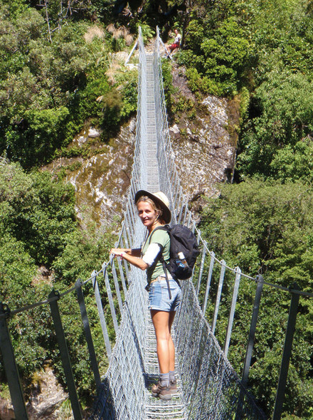
On the path of the Copland Track, at the foot of Mont Cook. New Zealand is a walker’s paradise.
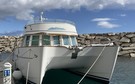
It has now been four months since we arrived in New Zealand. The Western Pacific cyclone season is coming to an end. We loaded our bags back on board Jangada on February 15th, in the very sheltered marina at Marsden Cove. We started getting the boat ready. Barbara and the children got stuck back into the home-schooling every morning. 4 hours of it. That’s tough! I finished the last few technical jobs and the checks. We put the refrigerator back in service, as well as the watermaker. The new pumps (fresh water and gray water) installed while we were on the hard at Norsand Boatyard all worked well. The toilets, fully disassembled, and cleaned and put back together (all the crew were involved!), have never worked so well at their humble but primordial job. One last problem was with our IT, having been ashore and made many Internet connections. Loading Google Chrome and various updates during our long stopover, doesn’t seem to have been to the liking of our Chopper software, which I use to view Grib files using the Maxsea program. After sailing halfway around the world, we are starting to have a good idea of the scale of interference between different software, antivirus protection and safety systems of all kinds on the function of navigation and communication essential to our on-board life when under sail. The solution? Have two separate computers, right from the start, and be extremely rigorous: one computer permanently on-board, for all the navigation and communication functions and for photo storage. This computer must never, but absolutely never, be taken ashore, nor connected to the Internet. And another, more mobile, to use for connections ashore or via wifi, watching movies, and for emails with large attachments via the Internet. After a few hours on the helpline, the system was working again.
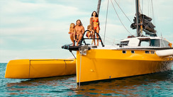
Back at Marsden Cove, the crew are making preparations to set off again…
This was the exact moment that the sea water pump from the refrigerator, no more than a year old, decided to break down! You have no doubt understood that to sail around the world in a non-austere fashion, though without excessive luxury - let’s say in a sober, but enjoyable fashion - you need to carry a good tool kit, backed up by a certain level of DIY skills… And being diplomatic is no bad thing either. For example, immediately announcing to your better half that this damned refrigerator is at it again, and that the temperature has really started to go up since you filled it up, might not be such a good idea, strategically speaking. Letting them know that you have come across “a small, surprising, technical glitch which is probably very temporary in this little technological marvel” is preferable… So you spend a few sleepless hours on your own trying to work out where this latest annoying problem has come from, just when you thought the long list of technical jobs “which absolutely must be done while we’re in New Zealand” was nearing its end…
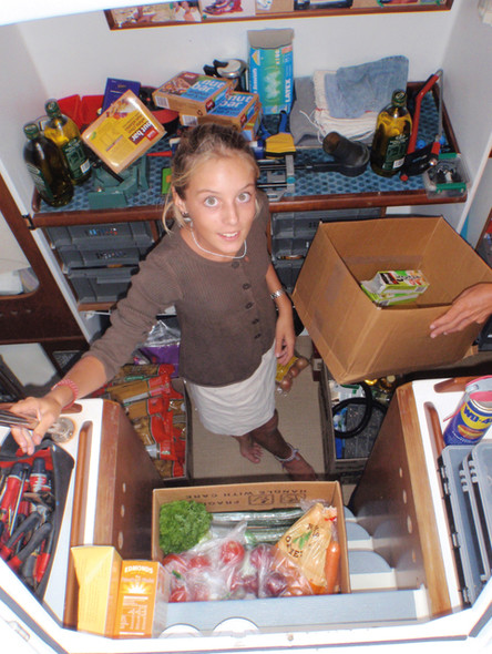
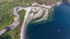
Eventually, the end of our stay at Marsden Cove was approaching. We made the most of our car to go and do a mega-shop at Pak’n Save in Whangerei, a store we know by heart. We came back with two big carts loaded with 500g packets of pasta, cartons of UHT milk, bags of flour and rice, condiments, packs of butter, jars of jam, a few bars of chocolate, fruit and vegetables, everything to make a mutton ragout as well, a few 3-liter boxes of wine, and a slab of Steinlager Classic. I forget what else. So… so I start to look at the chart of the islands to the south-east of Whangerei, toward Hauraki Gulf. Very soon, I’m dreaming of reaching Great Barrier Island, a long island which shelters, from offshore, Hauraki Gulf which is just off Auckland. There are many sheltered anchorages, to cater for all wind directions, often found in the region. A stay at Great Barrier Island, some 30 miles from Marsden Cove, seemed to me to be the perfect transition between hour-long stopovers ashore and the sailing life which we were about to reacquaint ourselves with.
I scanned the mouth of Whangarei’s Hatea River. A number popped into my head: 18,000 miles. We only had half the trip around the world left to do…
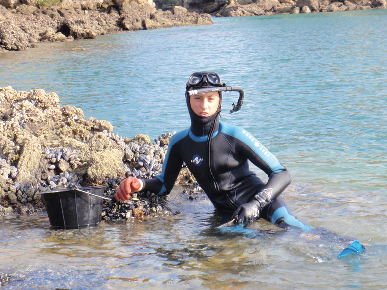
At Great Barrier Island, Marin ensures we have mussels for dinner, but there are no fries…
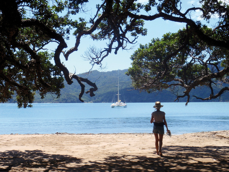
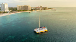
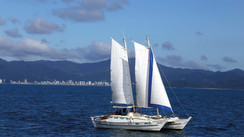
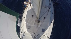
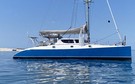
After an enjoyable four-month stopover, Jangada is setting off again to finish her trip around the world (here, in the Hauraki Gulf)…
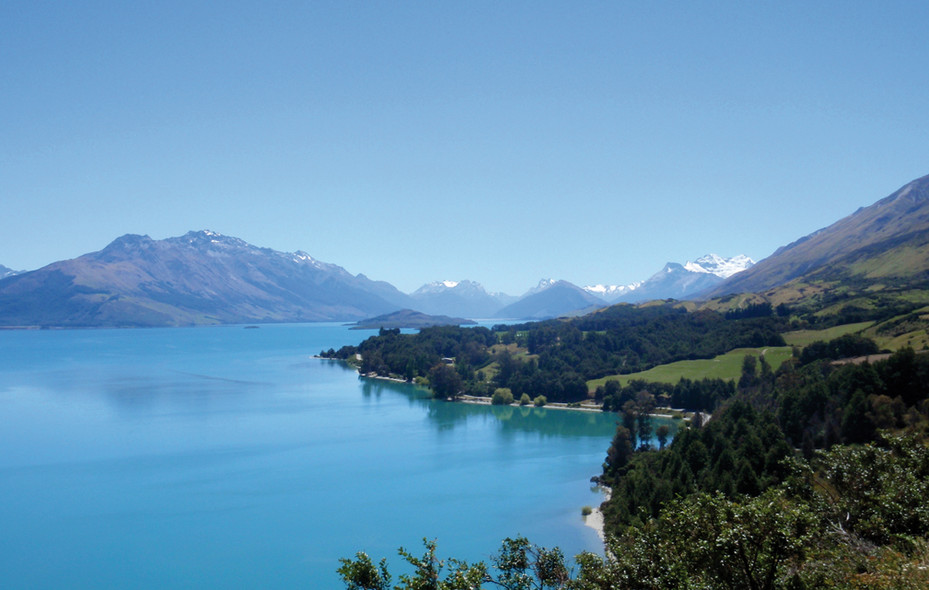
A lake near Queenstown, in the heart of South Island. Amazing countryside!


What readers think
Post a comment
No comments to show.