
Issue #: 170
Published: March / April 2020
- Price per issue - digital : 6.20€Digital magazine
- Price per issue - print : 8.50€Print magazine
- Access to Multihulls World digital archives Digital archives
In June, when the hurricane season is approaching, the traditional option for round the world sailors is to head south – Grenada, Columbia, Rio Dulce or one of the many other choices. However, there is a security issue. Whichever way you are travelling, there are some stretches of coastline that are best avoided. The eastern coast of the US is therefore a reasonable and very attractive alternative. Let’s head for the Chesapeake Bay.
Published 25/01/2020
Of course, there’s no point looking for those tropical paradise anchorages – we’re actually leaving them behind – but the Chesapeake Bay has a lot going for it, and there is a real sailing culture like at the Annapolis Boat Show, one of the biggest in the country.
The other interesting thing about the Chesapeake Bay, is the proximity of interesting sites that are easily accessible by car or RV: Washington DC, Shenandoah National Park, Niagara Falls and of course New York!
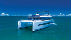
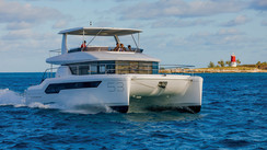
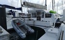
Cat’Leya, a Lagoon 52, left the Bahamas accompanied by her sistership Manjaro. The US is very close to the islands in the north of the archipelago – it’s only 48 nautical miles from Bimini Islands to Fort Lauderdale. However, our Lagoon’s air draft (over 27m / 88’) meant that we couldn’t make the trip under engine on the ICW (Intracoastal Waterway, which runs from Florida and follows the eastern seaboard as far as Norfolk, Virginia). The fixed bridges have a vertical clearance of 65 feet or 19.7m. So, we had to take the ocean route, helped along by the Gulf Stream. We decided to go as far as Orlando and visit Cape Canaveral. This was our only stopover before reaching the Chesapeake Bay.

If you aren’t an American citizen, you will need either a Visa or an ESTA to visit the States. If this is the case, the ESTA will only work if you first entrer the country via a “commercial” method of transport such as an airplane or cruise ship. If you are coming on your own boat, you will need to apply for a B2 Tourism VISA at your local American Embassy early enough to receive your Visa before entering the US territory (the process usually takes 3 to 5 weeks). That’s it for the formalities. What did cause us a problem though, was the entrance into the channel towards Orlando, where a 24-meter (79’) overhead cable prevented us from getting to the anchorage that we wanted. It’s a really good idea to study your charts very closely so that you don’t get caught out. But be aware also that some charts are not accurate… We finally managed to find a spot at a quayside in a marina and then went and cleared customs as soon as we were all tied up to the dock. We are currently waiting for weather conditions which will allow us to head up as far as the Chesapeake Bay, not forgetting that there will be the famous Cape Hatteras to negotiate on the way. This cape separates two great sailing areas: from Miami to Beaufort, NC in the south and from Beaufort to New York in the north. The Gulf Stream comes very close to the coast here. However, for the few days that we were there we were going to be tourists! We started with the J.F. Kennedy Space Center. The whole story of America’s conquest of space is here, with of course the story of the Saturn-Apollo era and the Space Shuttle “Discovery” itself! It was a truly magical moment for me and reminded me of my early career and the great hopes that we had for the European Hermes space shuttle program.
We then discovered the center of Orlando. It’s a mix of skyscrapers and old buildings and is in fact very pleasant, especially because of all the green areas which have been created around the city’s numerous lakes. It was a chance to recruit a new, very well-behaved crew member: a Fukien Tea Bonsai tree!

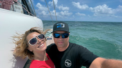
After a five-day stopover, there was finally a reasonable weather window. We had 600 nautical miles ahead of us, with the famous Cape Hatteras to negotiate but also the Gulf Stream to push us along… Thanks to this favorable current, which sometimes moves along at over 3 knots, we were regularly sailing at over 10 knots with one reef in the mainsail as far as Cape Hatteras. Given this zone’s reputation, we had checked out a safe anchorage in Beaufort just in case, but up to that point everything was going well so we pressed on. The Gribs were forecasting that the wind would turn easterly and pick up. It did in fact pick up, and we took in another reef in anticipation. Unfortunately, it was more of a north-easterly and generated a strong swell. Cape Hatteras was definitely living up to its reputation! That night saw the worst sailing conditions since we had left France. I stayed at the helm to make sure that Cat’Leya avoided the worst of the night-time waves. Halfway around, the coastline curves slightly towards the west, which facilitated our passage through the water. It had taken us almost 20 hours to cover 100 nautical miles, with the engine running for the first half when we were sailing into the wind. Behind us, Eclekti (a monohull that I had contacted by radio) and Fine Tuna (a sport fishing boat) had turned back… At the entrance to the bay we headed into the channel until a siren started to screech behind Cat’Leya. It was the USS72 aircraft carrier. Her crew contacted me by radio and told me to immediately free up the channel to allow access. We did not protest! We spotted five aircraft carriers in what is one of the world’s largest naval bases: Norfolk, at the entrance to the Elizabeth River.
So, we had made it into the Chesapeake Bay! The crab traps had started to appear: they go down to around 15m (50’) on lines dropped by the fishermen and are indicated by buoys and flags. We were looking forward to tasting these famous blue crabs! We moored at Mill Creek, near Fort Monroe in Hampton, which had been transformed into a residential estate of nice villas with manicured lawns and no fences between the properties as is the custom here. The next evening, we tasted the Norfolk crabs in a restaurant. Spot on choice!
After a well-deserved rest, we headed for Norfolk, or more precisely Hospital Point, which is between Norfolk and Portsmouth, and right in the town center on the Elizabeth River where the traffic wouldn’t bother us at all. Norfolk is a fairly small town. A few skyscrapers and lots of monuments in memory of American servicemen. One of them is dedicated to General MacArthur. Portsmouth, on the other bank is a residential town. One other particularity about the bay is that all the banks are occupied by very nice houses with private docks and lawns right down to the water’s edge.

After Norfolk, we pointed ours bows in the direction of the historic center of American independence: Yorktown – Williamsburg – Jamestown. These were the sites of battles which finally ended in defeat for the English and the Declaration of Independence. At Yorktown, the free Americans had their first taste of victory, helped in part by the French whose fleet managed to block the arrival of English reinforcements in the bay.
We sailed up the York River as far as Yorktown and moored Cat’Leya by the bridge. From there we visited Williamsburg where a park backed by the Rockefeller Fund has recreated the town at the time of independence.
After our stay in the cradle of American independence, we left civilization behind to go and explore the eastern coast of the bay, which was supposed to be a bit wilder. We began our adventure with Tangier Island. It’s a very small town which owes its survival to fishing and in particular the blue crab…
The wind was from the south-east and we anchored in 4 meters (15’) of water on the village side, 200 meters (660’) from the shore and opposite the more usual anchorage at Cod Harbor.
We moored the dinghy in what resembled a marina with slightly rickety pontoons. An old man called over to us. He said that storms were forecast from the north-west and that in this area of the bay it can quickly hit 45 knots. It would therefore be better to moor at his dock… We decided to make a see about it later. We went for a walk and to look for a restaurant for dinner. There was no cellphone signal here. We were finishing our crab cakes when our friend turned up again looking for us. However, given the state of his pontoons which definitely didn’t fill me with confidence, I decided to change anchorage and head for Cod Harbor which was sheltered from the north-west… but not from the swell generated by the south-easterly winds. I had just fallen asleep at around 12.30am, when I was awoken by a boat siren that was very close. I got up and saw a motor boat arriving from our starboard side. It was the Coast Guards, just a few feet away: “Do you have an EPIRB? Is it on?” I replied that it was in its box… “What ‘s the name of your boat? Yellow Bird?” No. Apparently Cat’Leya hadn’t had a lick of paint that evening, my AIS is working and therefore the name and position of the boat are perfectly visible…
That was the end of our stay in Tangier Island. The next day we left this pretty miserable anchorage and headed for Saint Michaels.

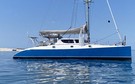
We headed north, passing the Cove Point lighthouse and then branched off onto the Miles River which leads towards Eastern Bay and Saint Michaels. The landscapes and topography of the Miles River reminded me of France’s Morbihan Gulf, and our adventures in our first catamaran. Along the shoreline there were still lovely houses with lawns right down to the water. After several meanders in the river which we were able to cut across thanks to Cat’Leya’s Forward Scan sonar, we saw St Michaels. We anchored off the entrance to the village. It’s a magnificent spot. We spent the afternoon in the maritime museum which explained everything about the local maritime professions, especially fishing for blue crab and oysters, which have long been St Michaels main source of wealth. In this area the oysters weren’t cultivated, but rather picked up off the seabed with a kind of rake that was dragged behind the fishing boats.
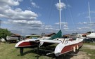
Thanks to this wealth, St Michaels became a large port where several shipyards built the working boats and in particular the Skipjacks. Today, these restored boats sometimes race in the Miles River. The crew members have to balance on poles to offset the listing of these keel-less boats.
In the sky, ospreys wheeled around looking for prey. In the evening we finally managed to try the crabs, this time steamed with a very spicy sauce – Old Bay - all accompanied by a local beer.
Sailing around the bay is fairly easy. You do still need to watch out for the tidal currents which are quite strong in some areas, and the crab pots. Annapolis, which is the home of the Annapolis Boat Shows, is also the headquarters of the Naval Academy, where the future sailors of the American navy are trained. It is possible to visit the fabulous military installations.
Our anchorage in front of the town allowed us to enjoy the hoisting of the flag every morning.
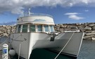
To end our trip, we headed in the direction of Baltimore, a little further north. Passing under the big bridge which spans the bay to the north of Annapolis was a bit hair-raising, but with 55m (180’) of clearance there was nothing to worry about. Baltimore was a blue-collar town for a long time, but has been working on its image as modern go-ahead place for some years. We headed up the Patapsco River and reached the anchorage in the heart of downtown. It’s a good, lively spot at the edge of the bay. Despite everything that we had read, we got a good hold on the seabed and there was more water than the charts indicated. Cat’Leya was the only boat there for the three days of our stay, and it was in fact very hot… From there we were able to stroll around Inner Harbor. We saw the USS Constellation, one of the very last sailing ships that had been built for the Navy and the American Visionary Art Museum.
After five months spent in the Chesapeake Bay, Cat’Leya and Manjaro began to feel cold… it was time to head back to the sunshine and soon the Pacific! We arrived back in Norfolk two days after leaving Annapolis. En route, Manjaro crossed paths with the ARC… no, not the rally but a cargo ship of the same name. It was windy, gusting up to 35 knots but with just a moderate swell. However, it was cold, and at night in Norfolk, the temperature dropped below freezing in our anchorage! The next leg would take us towards Florida and we would have to go around the famous Cape Hatteras where we had suffered so much on the way up. We set off on a Sunday when there was no wind, but there was still plenty of swell and it didn’t make for comfortable sailing. At least Cat’Leya’s hull got a good clean and slipped better through the water. We sailed along the coast for a few miles to take advantage of the Gulf Stream’s counter-currents which cannot be taken on head-on. After two days and nights at sea with an uncomfortable swell, we arrived at Savannah, Georgia, in the dark. However, there were no anchorages in the town so we decided to stop at Edisto beach in South Carolina. The anchorage was superb and it was already much warmer! We were at last able to get back into our old routine!
The next leg should have taken us straight to Fort Lauderdale, but the weather became very changeable, and the sea was obviously not in the mood to let us head for the sun… However, we got the chance to visit Palm Beach and to finally sail on the ICW. Sailing at 6 to 7 knots depending upon the zone, we would arrive at each bridge opening and it was actually all quite easy in the end…
Next was Fort Lauderdale, where maintenance was planned on the two catamarans. To reach the shipyard, we had to sail up the South River and go through countless bascule bridges – you need to call on VHF channel 9- as far as an overhead powerline at just 24m (78’). Luckily, this information was wrong and we were able to reach our destination.


What readers think
Post a comment
No comments to show.